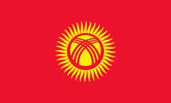
Isfana (Razzakov)
Razzaqov (Раззаков), formerly known as Isfana, is a small town in the extreme western end of Batken Region in southern Kyrgyzstan. The town is located in the southern part of the Fergana Valley, in a region surrounded on three sides by Tajikistan. It was renamed by President Sadyr Japarov in honour of Iskhak Razzakov on March 18, 2022.
Razzaqov has been inhabited since at least the 9th century. It underwent significant changes during the Soviet period. The selsoviet (rural council) of Isfana was established in 1937. The selsoviet was transformed into a village administration in 1996. In 2001, Askar Akayev issued a presidential decree to make Isfana into a town.
Razzaqov is the administrative center of Leylek District. The villages Myrza-Patcha, Samat, Chimgen, Taylan, Ak-Bulak, and Golbo are also governed by the Razzaqov Mayor's Office. As of 2021, the population of Razzaqov and the subordinated villages is 34,219. The population of Razzaqov itself is 23,038.
The word "isfana" is believed to have come from the Sogdian word asbanikat, asbanikent or aspanakent which means "the land of horses". According to historian Numon Negmatov, from the first to the ninth centuries Isfana was known as Asbanikat. From the 10th to the 12th centuries it was called Aspanikent. Starting from the 12th or 13th century the town's name gradually changed to Asbani, Aspana, Asvona, Isvona and, finally, to Isfana.
Since Isfana is not a Kyrgyz word, Kyrgyz nationalists called for renaming the town in honor of Iskhak Razzakov who served as the first secretary of the Communist Party of the Kyrgyz SSR. In December 2021, President Sadyr Japarov announced that he had made the decision to rename the town after Razzakov in the context of border tensions with neighboring Tajikistan. Later Japarov signed the Law "On renaming the city of Isfana, Leilek District, Batken Region, into the city of Razzakov", which was adopted by the Supreme Council on March 16, 2022.
Map - Isfana (Razzakov)
Map
Country - Kyrgyzstan
 |
 |
| Flag of Kyrgyzstan | |
Ethnic Kyrgyz make up the majority of the country's 6.6 million people, followed by significant minorities of Uzbeks and Russians. The Kyrgyz language is closely related to other Turkic languages.
Currency / Language
| ISO | Currency | Symbol | Significant figures |
|---|---|---|---|
| KGS | Kyrgyzstani som | Ñ | 2 |
| ISO | Language |
|---|---|
| KY | Kirghiz language |
| RU | Russian language |
| UZ | Uzbek language |


